Past, Present & Future Impacts of Drones on the AEC Industry

Advances in drone technology are transforming how AEC professionals approach infrastructure projects, moving beyond their initial novelty to become essential tools for efficiency and innovation. As a licensed FAA drone pilot with nearly two decades of experience, Bret Tremblay shares his first-hand observations on how drone usage has evolved and impacted the industry.
Meet Our Expert

The Evolution of Drones in AEC
In recent years, Benesch has leveraged drones equipped with thermal cameras to inspect bridge decks and parking garages, enabling the detection of concrete delamination that is often invisible to the naked eye.
In a head-to-head comparison on a bridge inspection project, the thermal drone method took 35% less time and cost 36% less than traditional techniques, while also identifying more areas of concern that might have otherwise gone unnoticed.
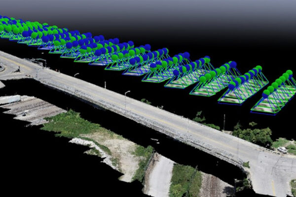
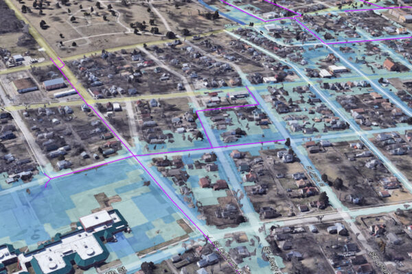
Beyond inspections, drones are used to create high-resolution aerial imagery, 3D models and digital twins of infrastructure assets. These models support asset management, design and construction monitoring, offering a comprehensive view of project sites that would be difficult or dangerous to obtain otherwise.
Now, the focus has turned to exploring how drones can be paired with artificial intelligence and machine learning to automate tasks like pavement crack detection, further streamlining workflows and reducing the need for extended site visits or lane closures. The integration of drone technology into project workflows not only enhances data collection and analysis but also minimizes disruptions to traffic and improves safety for inspection teams.
What’s Next?
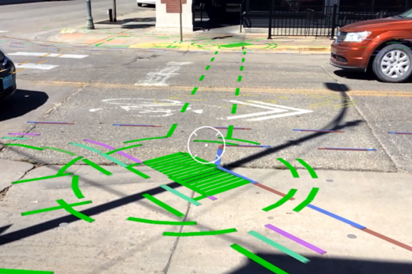
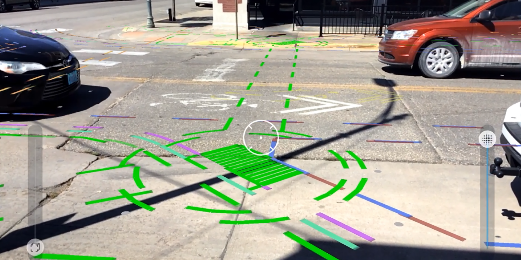
Looking ahead, we’ll continue to push the boundaries with drones by pairing them with augmented reality (AR) systems to reimagine designs while in the field, fostering efficiency and precision. By integrating AR with aerial drone data, civil engineers will be able to overlay digital models directly onto physical sites in real time, enabling instant visualization of proposed structures, utilities and modifications within the actual environment.
This fusion of technologies will streamline site inspections, improve decision-making through enhanced spatial context and significantly reduce design errors by allowing stakeholders to identify potential conflicts early in the construction process. Ultimately, fleets of AR-enabled drones will help bridge the gap between planning and execution, accelerating project timelines and elevating the accuracy of on-site implementation.
As drone technology continues to evolve, its role in the AEC industry is expected to expand, driving further innovation and delivering greater value to clients through smarter, faster and more cost-effective project delivery.
Stay in the loop by following us on LinkedIn for first access to our insights articles.